
Elkins wastewater system now using more geographic data
Trending
ELKINS -- The City of Elkins is increasing the use of Geographic Information System equipment and data by the Wastewater Department.
"The current work that the Wastewater Department is doing with the GIS system will make it easier to track changes throughout the city and help keep information up to date," Wastewater Chief Operator Whitney Hymes said. "Funding from ARPA (the American Rescue Plan) is progressing the city toward a more efficient and modern infrastructure."
The city first created a GIS Department in 2021, within the city's Operations Department, to create maps, reports and analytical data for the city's utilities, public services and other city departments and functions.
"To avoid the cost of a full-time GIS technician, the city now contracts for GIS support from the Region VII Planning and Development Council," a City of Elkins press release stated.
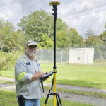
The city purchased new equipment and software using ARPA funds to make it easier for water, wastewater and other city employees to collect and use GIS data in the field. Employees can now map the location of underground infrastructure components at the time of installation or repair, making these items much easier to locate again during future excavations.
"The old way of analyzing and tracking data across the city was very time consuming and labor intensive," Hymes said. "Now we can use the GIS Collection System to streamline our processes, give access of better data to the public, and provide less burden on our Operations team."
"Geographic Information Systems bring together specialized hardware, software and experts to collect, manage and analyze data in terms of geography," the press release states. "GIS combines geographic elements with various data types, creating insightful visuals like maps and 3D scenes.
This newer technology gives the city the ability to record infrastructure information that is currently recorded on older paper maps."
The city currently offers multiple interactive public data applications. These applications update information in real time, providing interactive data that can be used to inform the public.