New Year’s Storm
13 inches of snow reported in Beverly
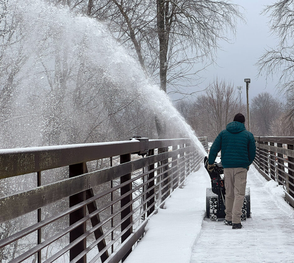
The Inter-Mountain photo by Taylor McKinnie Elkins Parks and Recreation Director Tom Tesar blows snow off of the bridge connecting Glendale and Riverbend Parks into the Tygart Valley River on Friday morning.
CHARLESTON — 13 inches of snow was reported on Rich Mountain after the New Year’s winter storm, National Weather Service officials state.
NWS lead meteorologist Megan Kiebler told The Inter-Mountain Friday morning that the organization received a report of 13 inches of snow in the Rich Mountain area of Beverly. A report from Davis & Elkins College stated that the Elkins area had received around 8.5 inches of snow, and the same amount was reported in the Valley Head area.
On Tuesday, Dec. 30, the National Weather Service issued a winter storm warning for most of north central West Virginia, including Randolph, Upshur, Barbour, Tucker and Pocohontas counties. The warning was in effect from 4 p.m. on New Year’s Eve to 10 a.m. New Year’s Day.
In Upshur County, 5.8 to 8 inches of snow were reported around the Buckhannon area. In Barbour County, 8 inches of snow were reported in Audra State Park with 4 inches reported in Philippi, according to the NWS.
Meanwhile, in Pocahontas County, 4 to 9 inches of snow were reported around Snowshoe with 5 to 7 inches being reported in Hillsboro, 1.2 inches reported in Green Bank and only 1 inch reported in Marlington.
As of press time, the NWS had received no reports out of Tucker County.
Early on Jan. 2, the National Weather Service stated in a social media post that winter weather advisories issued for parts of northeast Early on Friday, the National Weather Service stated in a social media post that winter weather advisories issued for parts of northeast West Virginia would remain in effect as “mixed precipitation” could bring up to 2 inches total snowfall that morning, along with a glaze of ice. The advisory was dropped at 11 a.m.
Kiebler said that, while there was a glaze of ice in the area, the organization had not received any reports of ice measurements.
“That was certainly out there today, especially with the refreezing and everything,” Kiebler told The Inter-Mountain Friday. “So that’s why we had that advisory going until 11 a.m. this morning for that possibility.”
Rain is expected for the area starting Tuesday, Jan. 6, raising questions on possible flood conditions. Kiebler stated that any snow melt could contribute to “any high water concerns.”
When asked if area residents should expect even more snow in this region of the state, Kiebler stated that the National Weather Service did not see any more snow “in the foreseeable future.”
Local News
Report: W.Va. struggling with tobacco cessation
CHARLESTON — Gov. Patrick Morrisey has preached the need for healthier lifestyles for West Virginians since ...

The Inter-Mountain’s Top 10 most-read online 2025 stories
New Year’s Storm

Tucker home deemed a total loss due to fire

Morrisey announces that WV has secured $199M