Snow Blankets Region
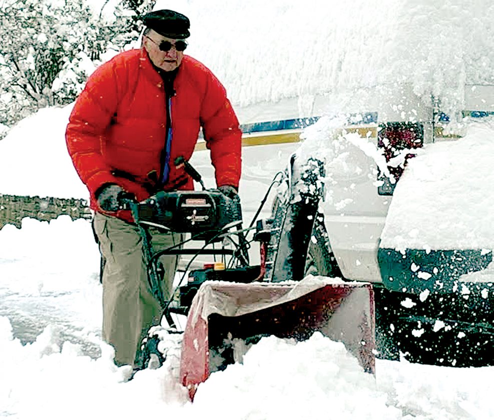
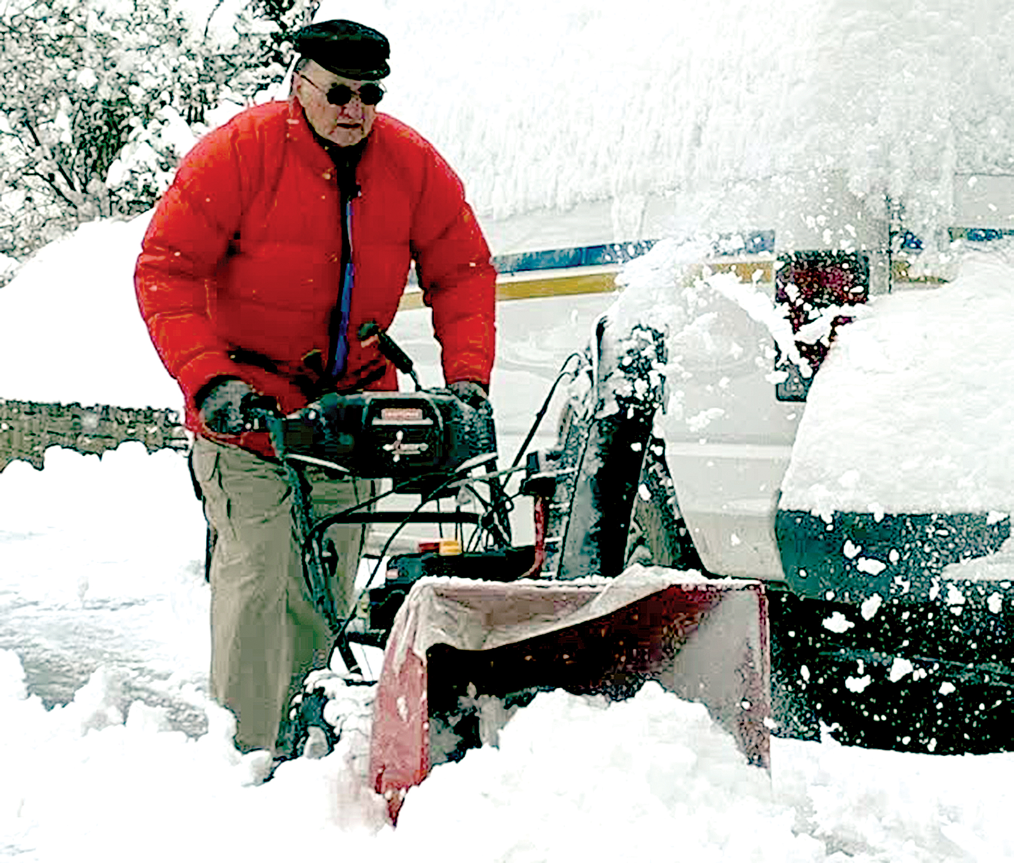
The Inter-Mountain photos by Edgar Kelley Emil Knutti uses his snow blower to remove snow from around several vehicles in front of his residence on Grandview Drive in Elkins Friday.
The Inter-Mountain photos by Edgar Kelley
Emil Knutti uses his snow blower to remove snow from around several vehicles in front of his residence on Grandview Drive in Elkins Friday.
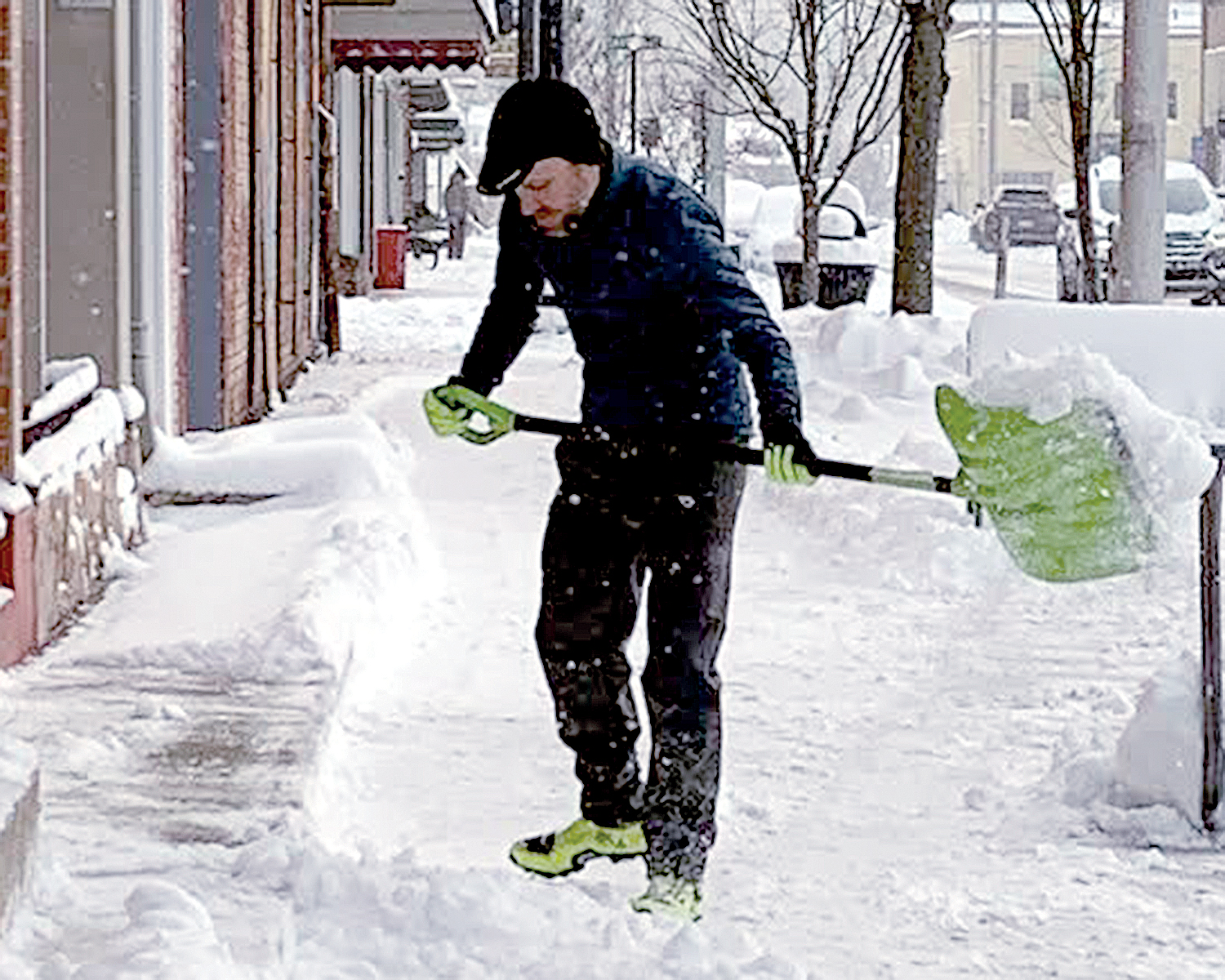
Joey Riddle, owner of Joey’s Bike on Third Street in Elkins, shovels the snow from the sidewalk in front of his store Friday morning.
ELKINS — Residents across Randolph and surrounding counties woke up to an abundance of snow Friday morning, as the first major winter storm of the season swept into the area Thursday and continued to produce accumulation through the night.
Much of the snowfall in the region happened between 7 p.m and midnight Thursday, when five inches or more fell, according to the National Weather Service in Charleston.
“Most of Randolph County saw around the amount of snow we predicted, but there were others like Mill Creek and Coalton that received a little more,” National Weather Service meteorologist Francis Kredensor told The Inter-Mountain Friday. “Most of the accumulation came late last night before midnight, as some of the areas in the county saw five or six inches in a four- to five-hour window.”
Mill Creek received the most snowfall in the county as it was hit with 14.5 inches, Kredensor said. Coalton saw 14 inches of snow, while Beverly had 11.5 and Elkins 10. Outside the county, Buckhannon also had 10 inches of snow, while Parsons came in at 9.5, Philippi at 8.1, and Belington at 7.5.
“We had that fresh cold air that came in and it kind of set the table for everything that we saw,” Kredensor said. “After seeing hardly any snowfall at all this season, the storm reminded us of how winter can really be here in West Virginia.”
Even though crews continued working hard to make the roads safe to drive on, Kredensor said many of the roadways could still potentially be dangerous this morning.
“A lot of the roads are still listed as ‘use caution’ and there are still even some that are listed as hazardous,” Kredensor said. “The roads are still a little dicey out there in some parts of the area and they likely will be on into Saturday morning.”
Despite hazardous road conditions in the area that affected commuters early Thursday afternoon and on through the night, Elkins Fire Department Chief Steve Himes said there were surprisingly few emergency calls in the Elkins area.
“We really didn’t have a whole lot going on, which is good,” Himes told The Inter-Mountain. “We had one accident early on in the evening when the storm started and one more after that later on in the night.”
Many accidents were reported along Corridor H Thursday afternoon and evening, however, and a portion of I-79 was shut down at one point Thursday evening.
Temperatures were expected to tumble through Friday night and on into this morning. Drivers should expect icy road conditions and frigid temperatures during early morning commutes.
“Temperatures are really going to drop fast after midnight on Friday,” Kredensor said. “The clearest skies will probably be getting there right before sunrise and that’s when we are expecting the coldest temperatures. Right now it’s looking like the coldest temperatures in the Elkins area could be between zero and five degrees. It will definitely be elevation dependent and some of those cold valleys could sneak below zero.”
Daytime temperatures today could reach up to 40 degrees, with sunny skies in the forecast.
Local News
Tygarts Valley Conservation District hosting hay class
PHILIPPI - The Tygarts Valley Conservation District Office will host a hay techniques, testing, and discussion ...
Randolph BOE to vote on Proximity Learning
ELKINS - The Randolph County Board of Education will vote on whether or not to make Proximity Learning available to ...

Special Ceremony

House of Delegates meets for informational meetings

Lawmakers briefed on new SAFE child welfare case system