Ice and Flooding
Area sees power loss, voluntary evacuation
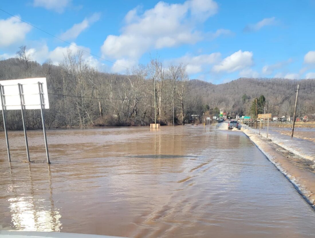
Photos by Joe Groves for The Inter-Mountain Floodwaters covered the roadway in Huttonsville in Randolph County Thursday afternoon.
ELKINS – Just when residents in Elkins and the surrounding area thought last weekend’s flooding issues were in their rearview mirror, early Thursday morning thunderstorms caused water to rise once again, while an ice storm created further issues in Pocahontas County.
Flooding and high water conditions in Randolph County led to Wednesday becoming and E-Learning Day for Randolph County Schools, with schools being closed to students. Schools in bordering counties Pocahontas and Pendleton were also closed, while students in Webster County were sent home early.
Randolph County Sheriff Rob Elbon told the Inter-Mountain Thursday that a water rescue was performed in the Huttonsville-Mill Creek area, which he said was the part of the county most affected by the rain.
“Emergency crews had to take someone out of the water up in that area,” Elbon said. “I also heard a call where (emergency personnel) were responding to Harman where someone had some water running through their house. Just when you thought the flooding was over, here we go again.”
Rob Daman, deputy director for the Randolph County Office of Emergency Management and 911, said during Thursday’s Randolph County Commission meeting some roads had been closed in the Huttonsville-Mill Creek area.
“We do have some roads up in the Huttonsville area that are currently closed,” Daman told the Commission. “They had a water rescue because of the road conditions, and the Huttonsville-Mill Creek Fire Department was dispatched. And they called the Elkins Fire Department dive team to help them.”
Residents in Pocahontas and Pendleton counties not only had to deal with flooding waters, but an ice storm caused havoc in those counties as well. According to the Pocahontas County Office of Emergency Management Facebook page, power outages were reported in several areas north of Marlinton Thursday morning, including in Dolley’s Mill, Clover Lick, Hiosterman, Green Bank, Arbovale, Boyer, and Bartow. The high water in those locations made it difficult for crews to restore power quickly. As of 3 p.m. Thursday, there were still people without electricity in those areas.
Although there were no reports of power outages in Pendleton County, several areas in the county had to deal with downed trees, which closed several roads in the county for a period of time.
Gov. Patrick Morrisey placed all 55 counties in West Virginia under a state of preparedness through Friday. A flood warning was issued in Randolph, Barbour and Upshur counties until 7 p.m. on Thursday.
Jeremy Michael, a meteorologist with the National Weather Service in Charleston, told The Inter-Mountain Thursday that, even though the rain would continue until late Thursday evening, another incoming weather system may cause more problems for the area.
“We do have another system coming this weekend,” Michael said. “We are getting into a pretty active pattern, there’s several opportunities for participation over the next week. Right now it looks like a quarter, to three-quarters of an inch of rain across the region. But there’s still a little bit of uncertainty, with it being a few days out. But with everything so swollen and saturated it won’t take much for it to cause more stream rises and flooding.”
Michael said rain should be expected Saturday morning, and then again late Saturday night into Sunday morning.
“It looks like the rain could stay south of the Elkins area, but it’s right on the edge,” Michael said.
Temperatures throughout the weekend are projected to be in the 40s during the daytime hours.
Local News

Two-Vehicle Crash at Intersection

Final Commencement
Discover Nature Day set for Seneca Rocks
SENECA ROCKS - The Monongahela National Forest will host a "Discover Nature Day" for children and families on ...

Deadline set to show Greenbrier loan details
Tucker to host national ham radio event
PARSONS - Ham radio operators from the Mountain State Transmitters, call sign K8VNQ, will be participating in a ...