
Weekend Flooding
Rain ended but waters still rose
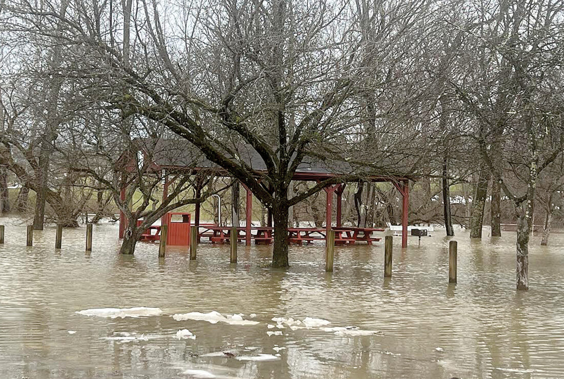
The Inter-Mountain photo by Edgar Kelley A pavilion at Riverbend Park in Elkins sits in a temporary lake of floodwater Saturday morning.
ELKINS — Floodwaters from Friday’s intense rains continued to rise in some parts of the area Saturday morning, in Randolph, Barbour and Upshur counties.
Although Saturday saw little rain, flood waters continued to cause problems. The Belington Bridge and the “Concrete Bridge” in Philippi were both closed in Barbour County Saturday due to flooding.
Officials blocked off the entrance to Glendale Park in Elkins Saturday, as floodwater covered the park’s roads and fields.
Hazardous weather conditions forced several streets and road closures in the area on Friday. Schools were dismissed early in multiple counties, including in Randolph, Barbour, Upshur, Tucker, and Pocahontas counties.
In Elkins, Randolph Avenue, by Colonial Court, and Jamaica Lane, near Cupp’s Furniture, were among several roads closed to traffic Friday.
A Flood Warning was issued by the National Weather Service to run through Saturday morning for the Randolph, Upshur, Barbour, Tucker, and Pocahontas counties.
An ice dam broke loose and caused water near Bemis to rise Friday evening, officials said.
The Randolph County Office of Emergency Management and 911 posted the following to social media just before 8 p.m.:
“An ice dam has broke loose off of Cheat Mountain, it has caused a 1 foot raise in water recorded near Bemis within the last hour. All lowland areas are advised to keep watch and use caution.”
Later, the Flood Warning for Randolph, Upshur and Pocahontas counties was extended until 4 a.m. Saturday.
The warning cautions of “stream, and river flooding caused by prior rainfall and melting snowpack continues, with the potential for isolated rock falls and landslides in some areas.
“Flooding of rivers, creeks, streams, and other low-lying and flood-prone locations is imminent or occurring. Streams and rivers continue to rise due to excess runoff from earlier rainfall and melting snowpack. Isolated rock falls and landslides remain possible.
“At 9:17 p.m., several creeks and rivers are near or over flood stage. Additionally, high water continues to impact some roads across the warned area. – Some locations that will experience flooding include… Elkins, Summersville, Richwood, Marlinton, Clay, Webster Springs, Cass Scenic Railroad, Greenbank, Addison (Webster Springs), Mill Creek, Camden-On-gauley, Holly River State Park, Snowshoe, Camden On Gauley, Dailey, Craigsville, Birch River, Harrison, Mingo and Beverly.”
The National Weather Service is not predicting significant rain for the area until Wednesday, when there is an 80% chance of rain in the Elkins area.
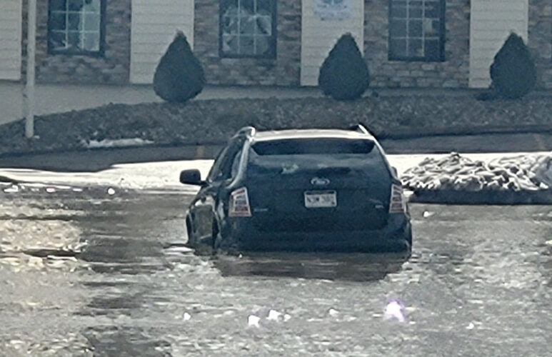
The Inter-Mountain photo by Kristi Groves
A parked car is surrounded by floodwater at Jawbone Park in Buckhannon Saturday.
Local News
Tucker home destroyed by fire, explosion
PARSONS - A Tucker County woman's home was deemed a total loss and she was transported by Health Net to Pittsburgh ...
Community Calendar
EDITOR’S NOTE: The Community Calendar is reserved for nonprofit, civic organizations. Unless otherwise noted, ...

Randolph superintendent seeks update on State of Emergency

Man accused of stealing $412K from his mother

Lemonade Stand All-Stars
Pack provides school disqualification details
CHARLESTON – State Treasurer Larry Pack released information this week about why a private school in Beverly has ...